

Recently, I finished reading Edward O. Wilson’s The Social Conquest of Earth. In it, Wilson seeks answers to fundamental questions such as Where do we come from?, What are we?, and Where are we going? – the three questions forming the title of his favorite work of art by Paul Gaugin (shown above and on display at Museum of Fine Arts, Boston, MA). Although The Social Conquest of Earth is touted for its interdisciplinary depth and associated findings, it nonetheless suffers from all the bad science related to geology’s “no worldwide flood, ever” blunder. As such, I wrote to him the following email:
“Prof. Wilson,
Having read The Social Conquest of Earth, I think it appropriate to bring to your attention my recent paper, The Flooding of the Mediterranean Basin at the Younger-Dryas Boundary, available here. It identifies and corrects a major scientific error, geology’s prevailing ‘no flood, ever’ paradigm. Among the consequences is this overlooked fact: humans are ill-adapted to the post-flood ecosystem into which we survived (discussion here). Our maladaptation accounts for our environmental abuses.
Best wishes,
Michael Jaye, PhD”
Prof. Wilson did not reply prior to his death.
Nonetheless, I address some of his book’s errors in the following essay.
Science
Wilson writes about science and its role in searching for objective truth. He says, “Science…is the wellspring of all the knowledge we have of the real world that can be tested and fitted to preexisting knowledge [italics added]. It is the arsenal of technologies and inferential mathematics needed to distinguish the true from the false. It formulates the principles and formulas that tie all this knowledge together. Science belongs to everybody. Its constituent parts can be challenged by anybody in the world who has sufficient information to do so.”
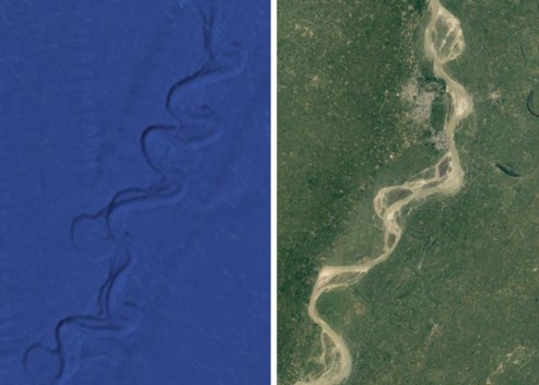
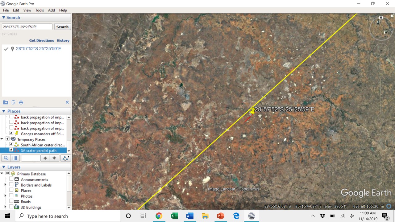
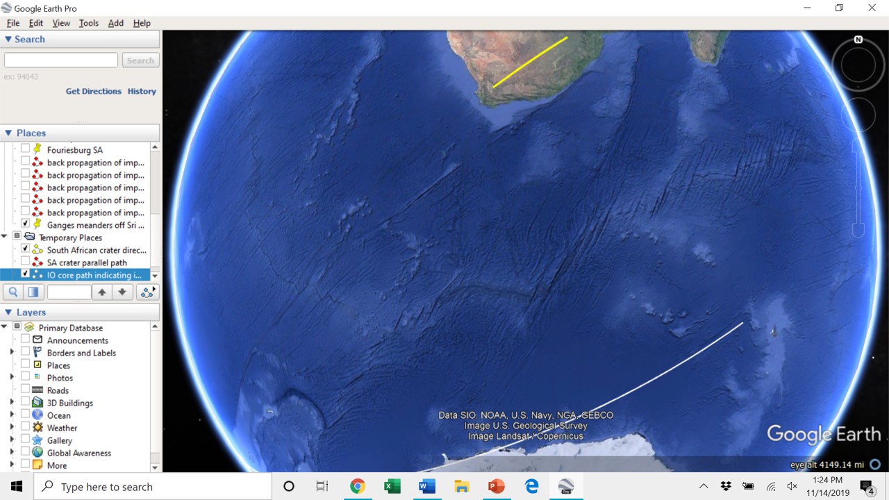
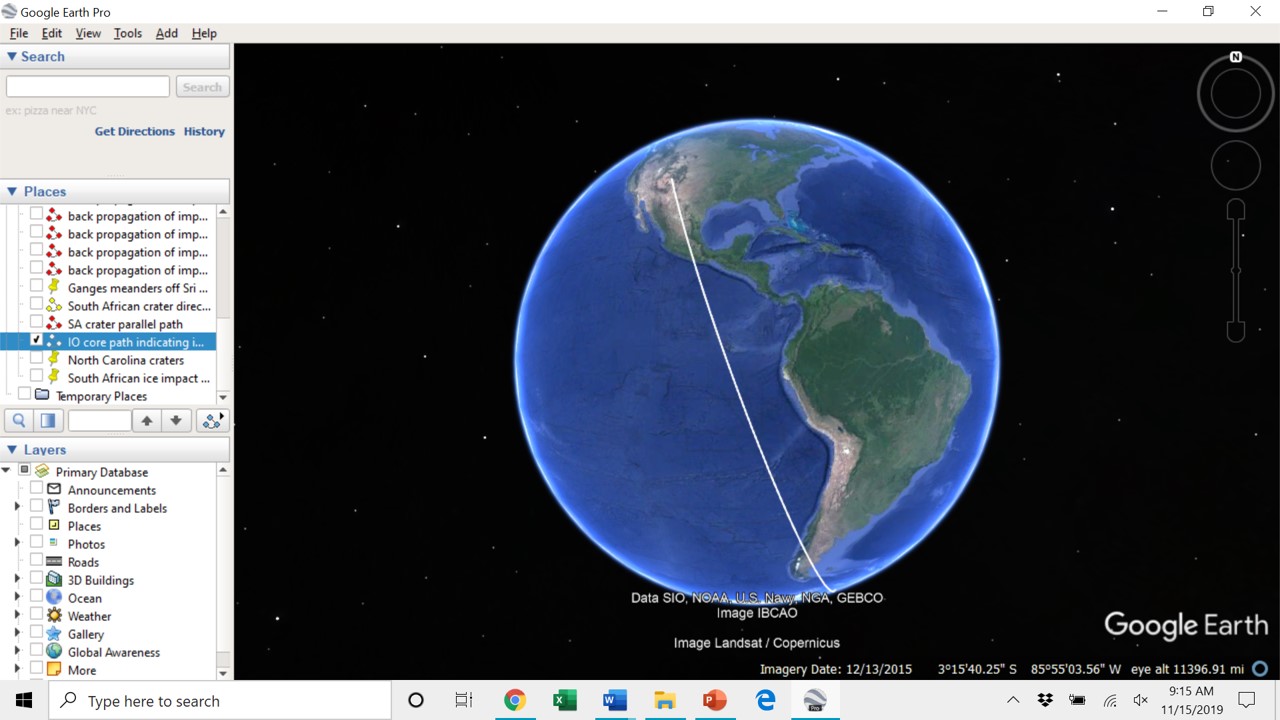
Google Maps (satellite view) and Google Earth provide new and sufficient information to challenge and overturn a fundamental tenet in one of science’s constituent parts, geology. The new maps allow us to see the topography of the ocean floors, and they reveal submerged river systems throughout the planet, some of which extend hundreds of miles into abyssal plains, and most of which are beneath more than two miles of water. Anyone who has studied fluid dynamics would recognize that concentrated flows could not persist over such distances, particularly through abyssal plains where causational, gravitational gradients would be minimal. In fact, out in abyssal plains the greatest gravitational gradients would be perpendicular to channel beds, meaning that the channels beds could not exist. Yet, there they are. Furthermore, cores obtained from some of these submerged river beds contain terrestrial sands, gravels, and even ancient tree remnants (see here). If hypothesized, high-speed subsurface flows carved these features – as geologists claim, then why do the channel beds exist? Wouldn’t the flow speeds scour the beds? How would meanders form? And how could channel beds contain terrestrial materials? These are rhetorical, sarcastic questions, because geologists’ claim that the submerged structures were carved by turbidity flows is an example of fitting observations (channels) to “no Flood” theory. It is fantasy masquerading as science.
The new maps caused me to investigate why geologists believe that there was never a worldwide flood, and what I found is indisputable: Adam Sedgwick erred when he concluded (in 1831) that there was never a worldwide flood. From the evidence before him, Sedgwick should have concluded that presently subaerial landscapes were never subjected to a common flood. Who would dispute the fact that presently exposed landscapes were never subjected to a common flood event? No one. So, let us be clear: that presently exposed landscapes were never flooded is wholly different from the claim that there was never a worldwide flood. Sedgwick erroneously passed judgment on submerged landscapes whose topography he could not observe – no one could see into the abyss until the maps were published about a decade ago. Sedgwick assumed that all of Earth’s waters have been here since its beginning thereby negating the existence of the very thing he sought! Had Sedgwick drawn the correct conclusion, had we waited nearly 200 years to decide the Flood matter when the maps would provide indisputable evidence of submerged river systems, then it would have been obvious: there was a worldwide flood. Unfortunately for geology and anthropology, all that has followed from Sedgwick’s error is likely wrong – practitioners in these disciplines have been fitting all subsequent observations to erroneous theory for nearly two centuries. Perhaps worse, Sedgwick’s “no Flood” finding has been accepted and celebrated for so long that anyone thinking otherwise is automatically castigated as an unscientific, bible-thumping rube.
Speaking of unscientific, please note that Wilson’s definition of ‘science’ includes the phrase “fitted to preexisting knowledge.” As mentioned above, this is absolutely wrong – we do not fit observations to preexisting knowledge; if observations contradict what is known, then it is the “knowledge” that must be challenged and then discarded. That someone of Wilson’s stature (he’s professor emeritus of Organismic & Evolutionary Biology at Harvard) would include “fitting” observations and conclusions to “preexisting knowledge” indicates that he recognizes the speculative nature of his work. As such, he defined science in such a manner so as to make his work scientific….
Where are we from?
When Wilson addresses “Where are we from?,” he writes: “The cradle of humanity was not the deep rainforests with their towering canopies and dark interiors. Nor was it the relatively featureless grasslands and deserts. Rather, humanity was born in the savanna forest, favored by its complex mosaic of different local habitats.”
His claim that we are out of Africa is a well-accepted tenet in anthropology, inferred from the notion that we evolved from extinct, related species whose remnants and artefacts have been found in Africa. This belief, repeated so often and accepted as true for so long, is an example of fitting observations (bones, tools, etc.) into what is supposedly known. Thus, we are out of Africa because that is where the artefacts were discovered and because we and our ancestors have been occupying presently exposed landscapes for hundreds of millions of years. This belief is a consequence of “no Flood,” and it is wrong.
Instead, we come from landscapes that are now under more than two miles of water – our homelands were submerged approximately 12,800 years ago during a planet-altering event that took place in a geological eyeblink. Rather than being “out of Africa,” we are instead from vast portions of the dark tan regions depicted on the map below, a model of pre-Flood Earth (found in my paper and book). The blue regions approximate pre-flood oceans and seas, and the beige regions represent presently exposed landscapes.
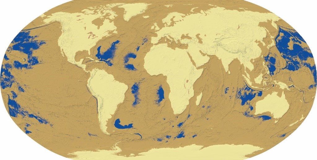
With more than two miles of water graphically removed, a model of land and sea distributions in pre-flood Earth shows previously exposed but now-submerged landscapes (tan), presently exposed landscapes (beige), and former oceans and seas (blue).
A few comments about the map: (1) The atmosphere would have occupied abyssal (tan) regions, which means that the beige regions were much cooler because they were more than two miles above them. The adiabatic lapse rate has temperatures decrease approximately 3.5oF per thousand feet, meaning that temperatures in the tan, abyssal pre-Flood regions were roughly 50oF warmer than the beige regions. (2) The Flood’s waters present an incredible heat sink, so pre-Flood Earth would have been much, much warmer than the present. (3) The thick layer of atmosphere above non-tropical tan regions would have attenuated the sun’s higher wavelengths; tan and beige regions at equatorial to tropical latitudes would have been subjected to much stronger UV light than non-tropical regions. (4) The tallest mountain peaks were at the limits of, perhaps even above, the pre-Flood atmosphere. (5) Due to atmospheric attenuation, all but the highest magnitude stars and planets would have been invisible in the tan regions.
From all this, we can infer that humans are furless because we evolved in the warm, abyssal regions; our ape relatives have fur because the pre-Flood landscapes to which they adapted (beige regions) were so much cooler. All mammals, living and extinct, including other homo species, whose remnants have been discovered in presently exposed landscapes (beige) would have required fur for survival.
Ancestors of darker-skinned humans evolved in tropical or equatorial latitudes where UV rays would have penetrated to occupied landscapes; hence, their melanin content. Likewise, lighter-skinned humans evolved in non-tropical latitudes where the atmosphere would have attenuated higher frequency wavelengths. Atmospheric attenuation also accounts for a recent finding that claims humans began seeing blue only recently.
Regarding our supposed relatives from Africa: their remnants were discovered in landscapes that we did not occupy. If they were relatives of homo sapiens, then they migrated down into the abyss from what are now African landscapes, and, over millions and millions of years in abyssal regions, they somehow evolved into homo sapiens. How did that happen? How long did it take? Open questions.
When one considers the vast, pre-Flood regions that humans occupied, it becomes obvious that an unimaginable number would drown in the Flood. Simple exponential growth models based on pre-industrial age population estimates indicate that Flood survivors would number in the thousands. Some would make it by boat; others, likely outcasts, would have been living in pre-flood upland regions; many would have lived in the pre-flood Mediterranean basin.
Med denizens had a survival advantage, time, because it took weeks after the celestial impact until its Flood waters attained such a height so as to afford passage into the basin through what is now the Strait of Gibraltar. During that period, Med inhabitants would have recognized the impact-induced changes to their weather, which would have included uncharacteristic cold as well as persistent rains. When the Flood waters appeared, Med survivors either boarded whatever crafts might have been available, or they fled upward. (Thus, the legend of Noah’s Ark originates from Med survivors.)
Those who inhabited pre-Flood regions near those countries now bordering the Med had relatively short distances to cover in order to attain safety. This explains the human DNA heat map, shown below, that implies by density (darkest coloration) where a certain trait finds its origin. Note that regions of greatest concentration for this particular trait (Mediterranean Admixture) are found along the Mediterranean basin’s shoreline.

Others survived upward. The Haida, noted seafarers, followed the Pacific shoreline eastward on the Flood’s rising waters. COL James Churchward investigated ancient writings in India and other parts of southeast Asia, and from them he introduced to us the legend of Lemuria (Mu), a civilization of common people that spanned large portions of the Pacific basin (discussed here). His work suffered rebuke and marginalization because it contradicted “no Flood.” Yet the DNA map, below, shows that Lemuria’s surviving descendants from Australia are closely linked to its survivors in South America.

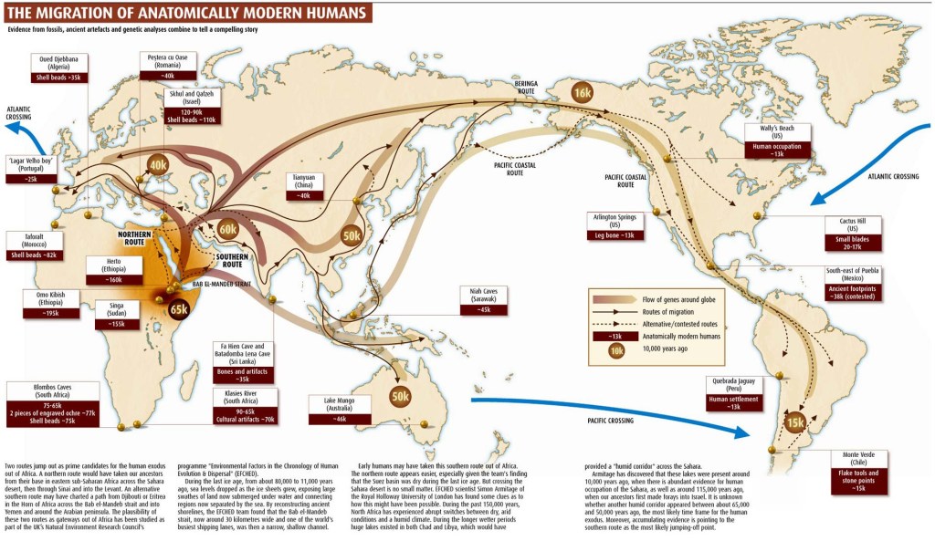
In an attempt to fit the DNA similarities to the consequences of “no Flood,” anthropologists concocted the human migration map, below (from TransPacificproject.com). From it, we are supposed to believe that, during the last ice age, native Australians made their way northward! more than 10,000 km through Asia, crossed some hypothesized land bridge through either the Bering Strait or the Aleutian Atoll, then made their way more than another 10,000 km to South America – all the while doing this without leaving their DNA signature!? Pure fantasy.
Atlantis existed, too. For those interested, my Explorers Club talk “Resolving the Problem of Atlantis” is available here.
It would not be over for survivors once The Flood’s waters attained their present level, as they would encounter a much cooler Earth. Unlike the environment for which they were adapted, the new Earth would require adequate clothing, as well as warm shelter and suitable food. Caves would provide immediate shelter, and campfires would constitute gathering places that provided warmth and food. Imagine the consequences involved with acquiring adequate food sources in this new, cooler environment while maintaining warmth and shelter…. It would take cooperation to survive; division of labor would be a necessary consequence.
Within the first few years after the Flood, survivors would have to deal with effects induced by the new, ocean-driven weather patterns that would transform the planet (e.g. pre-flood rain forests became deserts and vice versa, inland seas would evaporate, etc.). The post-Flood Earth environment would cause mass extinctions because many species could neither adapt nor find suitable habitats (they are now among the known Younger-Dryas extinctions). The changed weather would cause humans to migrate in search of adaptable regions bearing resources necessary for survival, some of which might be correctly depicted in the TransPacificproject.com map.
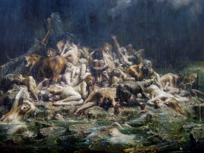
The story of Adam and Eve is a Flood legend. Naked humans were ejected from their natural, pre-Flood landscapes (Eden), and their survival into post-Flood ecosystems changed their nature – they had to toil to survive. The snake, Satan, is a metaphor for the immense, comet-like object that delivered the Flood (described in my paper). Note the snakes in the painting, below, as well as the Chinese New Year dragon-like serpent that is depicted above the clouds with water emanating from its mouth (representing the Flood that it delivered).

A slight, yet related, aside: the various species of animals and birds found in the Galapagos chain either survived upward into landscapes that were suitable for their pre-Flood adaptations, or they were there prior to the Flood. Imagine what was lost….
What are we?
According to Wison, “Humanity is a biological species in a biological world. In every function of our bodies and mind and at every level, we are exquisitely well adapted to live on this particular planet.” One need only look about to recognize how wrong this statement is: we are clothed, we live in buildings that provide shelter and warmth, we eat processed foods – none of this is naturally occurring. These simple, omnipresent observations indicate that we are a maladapted species.
Because we are maladapted, we continuously struggle to find suitable environments and food. A consequential, important idea: our continued survival necessitates the use (abuse?) of Earth’s resources. Wilson agrees with this, as he observes that humans “are an evolutionary chimera, living on intelligence steered by the demands of animal instinct. This is the reason we are mindlessly dismantling the biosphere, and with it, our own prospects for permanent existence.”
We are also eusocial, about which Wilson says, “Our ancestors were one of only two dozen or so animal lines ever to evolve eusociality, the next major level of biological organization above the organismic. There, group members across two or more generations stay together, cooperate, care for the young, and divide labor in a way favoring reproduction of some individuals over that of others.” I have no idea what humans encountered in the pre-flood abyss, but it is certain that it was there that we acquired necessary eusocial behaviors. Abyssal plains are likely to have been grassy, which would account for our upright posture and height. Families would have created nest sites near rivers and lakes. There they likely divided labor – e.g. hunters and gatherers would set about to acquire whatever food was available within walking distance (what was our pre-Flood diet?). Larger nesting regions, cities and states, certainly existed (e.g. the aforementioned Lemuria and Atlantis).
Because of our brains, we now dominate the biosphere; all other species that survived and could adapt to the post-Flood biosphere have not had time to adjust to our presence. As Wilson says, they “were not prepared for the onslaught.” However, our numbers are constrained by Earth’s finite, non-renewable resources that dictate its carrying capacity. We are our only predators, now capable of creating and distributing weapons of mass destruction, including biological weapons.
What lifted us to this god-like estate? Wilson calls this a question of enormous importance for self-understanding. The answer: The Flood. In the correct context that there was a worldwide Flood and that we are a surviving, sentient, maladapted species, then it follows that all social structures, infrastructures, and economies that have arisen over the last 12,800 years have been directed toward our survival.
Where are we going?
In the literal sense, until we discover a planet that exactly resembles pre-Flood Earth, then, as Wilson states, “nobody is going to emigrate from this planet, not ever.” Should such a planet exist, it will be outside our solar system, making it so distant as to be unattainable. Therefore, extra-terrestrial travel would constitute a waste of resources.
In a figurative sense, it seems to me that a universal, correct understanding of our past might play a significant part in helping us to better survive. Unfortunately, based on the minimal response to my findings, such a realization seems unlikely. So, I consider it quite likely that someone is going to initiate an event that will have Flood-like consequences , and it’s likely to be biological….
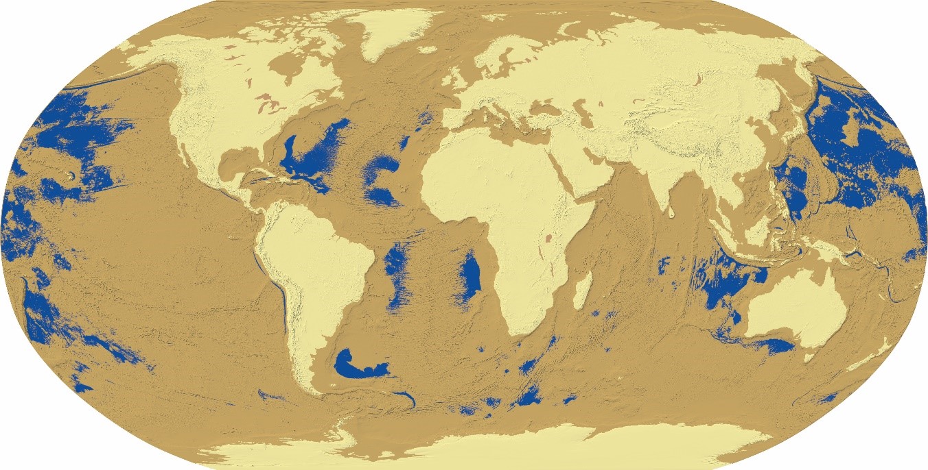


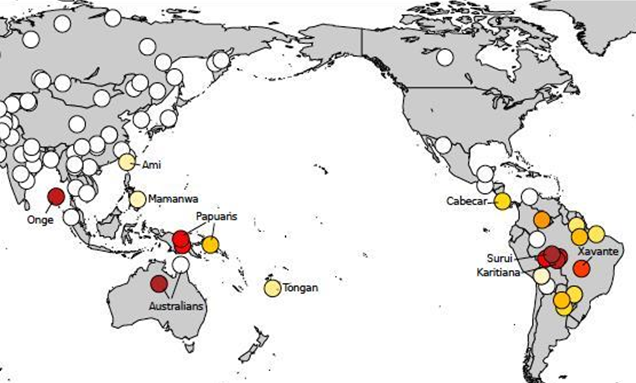


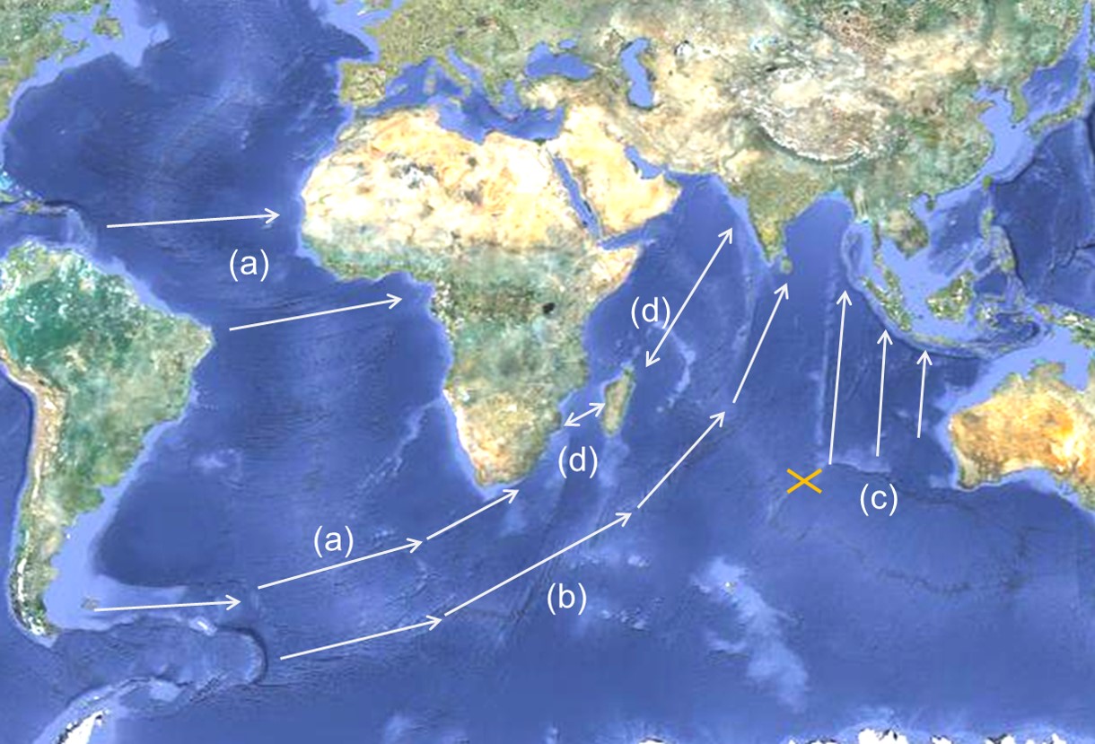
 Figure 3. The white arrow identifies India’s transit on the sphere, a great circle route.
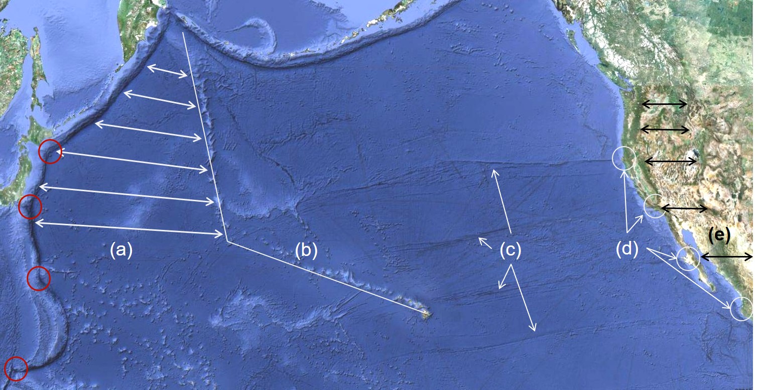 Figure 5. (a) White double arrows indicate North America’s land mass compression region, forming the Rocky Mountains; (b) North America’s release line; (c) scours created by (d) drag locations (white circles) which unfurled compressed landscapes during continental transit, creating valleys, gulfs, and faults along the western coast; prior to the simultaneous impacts, the red circled regions along the western Pacific boundary were connected to the white circled drag locations found along the west coast of North America. The Mexican Peninsula is particularly disfigured by North America’s transit; faults and consequent earthquakes persist due to landmass deformation; (e) black double arrows indicate the region unfurled by westward-acting drag forces during North America’s eastward transit.
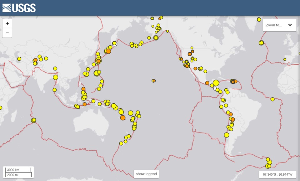 Figure 6. Plate boundaries and recent seismic activity are shown on this USGS map.
 Figure 7. The southern impact trough coincides with lines of latitude.
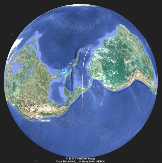
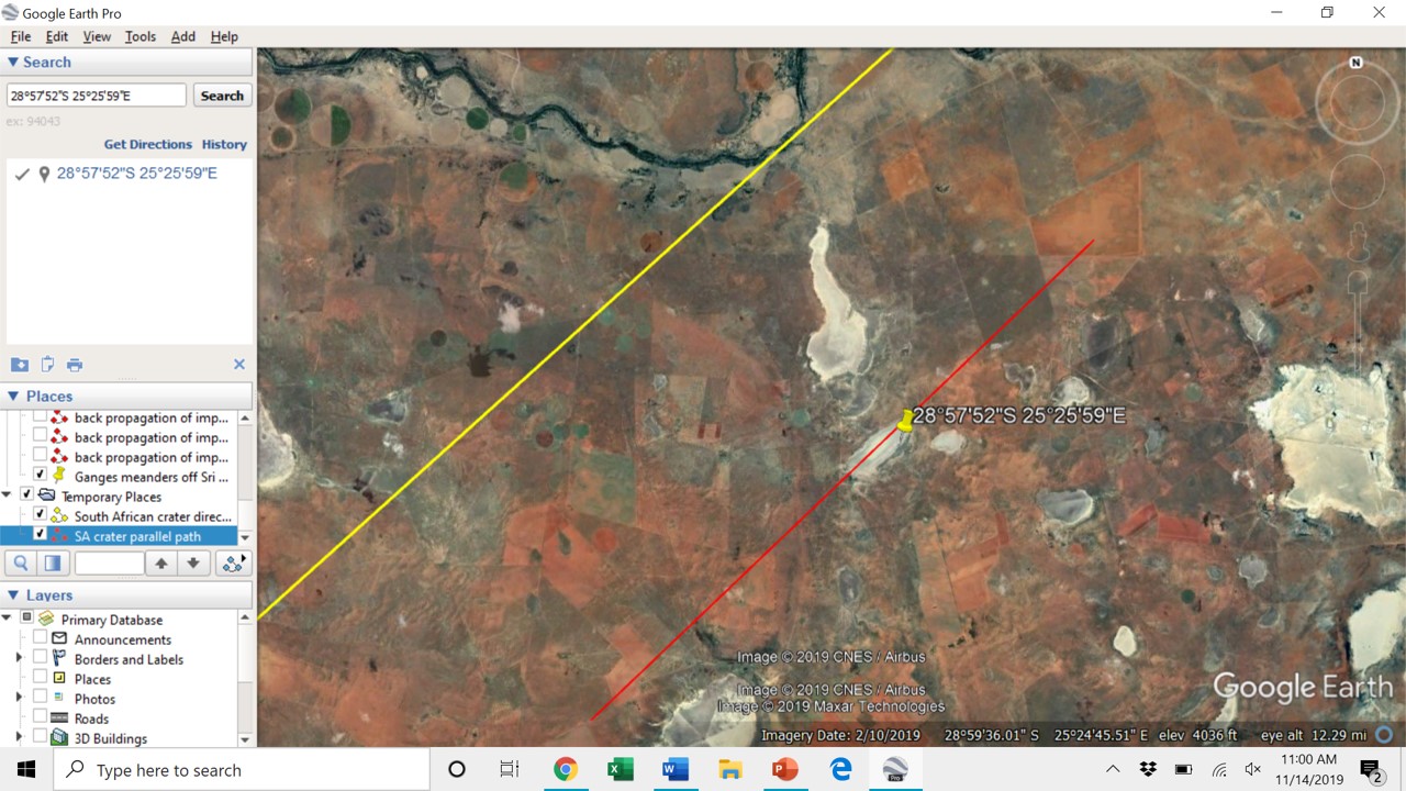
 Figure 9. Scrapes left by drag mechanisms correspond to volcanoes in the Hawaiian Islands.
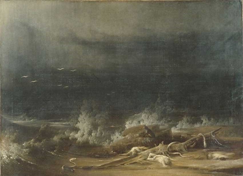 The Deluge towards its close by Joshua Shaw, 1813 (public domain)


