A recent paper titled, “Sustained wood burial in the Bengal Fan over the last 19 My” states that “wood was not widely thought to survive export and burial in the oceans. This study shows that woody debris can survive thousands of kilometers of transport in rivers and in turbidites, to be deposited in the fan. Wood has been overlooked in quantification of organic carbon burial on continental margins.”
The notion that millions-year old wood could be found at various depths in the sediment column (meaning that the deposits occurred millions of years apart) – at the exact same location, thousands of miles from shore and more than two miles below present sea level! – should cause the authors, reviewers, and any scientist to question the matter. For, what is the probability that trees would float to the same spot, thousands of miles from the present coastline, sink more than two miles, and then become quickly covered in sediment so as to survive for millions of years? How did the sediments get there?! Where did the sediments originate?! What mechanism transported these tree-preserving sediments (in essentially stagnant water)?!
All rhetorical questions, for the idea that the trees became submerged thousands of miles from shore is as absurd as thinking that Monterey Canyon was created by subsurface flows. The paper’s statement is yet another example of geologists fitting observations to their erroneous “no flood, ever” paradigm. It is fantasy masquerading as science.
I cannot believe that otherwise intelligent humans could put forth such garbage and then have it reviewed and accepted for publication as fact. So, over the past few days, I’ve engaged geologists, including one of the authors of the study, about the matter. What follows is the essence of the conversations, a presentation and analysis of Google Earth images from the region. Here is what I wrote:
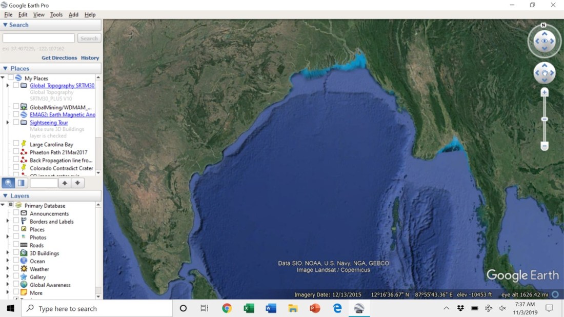
– The first image is a screenshot of the Ganges system draining into the Bay, as well as its bed that flowed down the continental shelf (top center of screenshot).
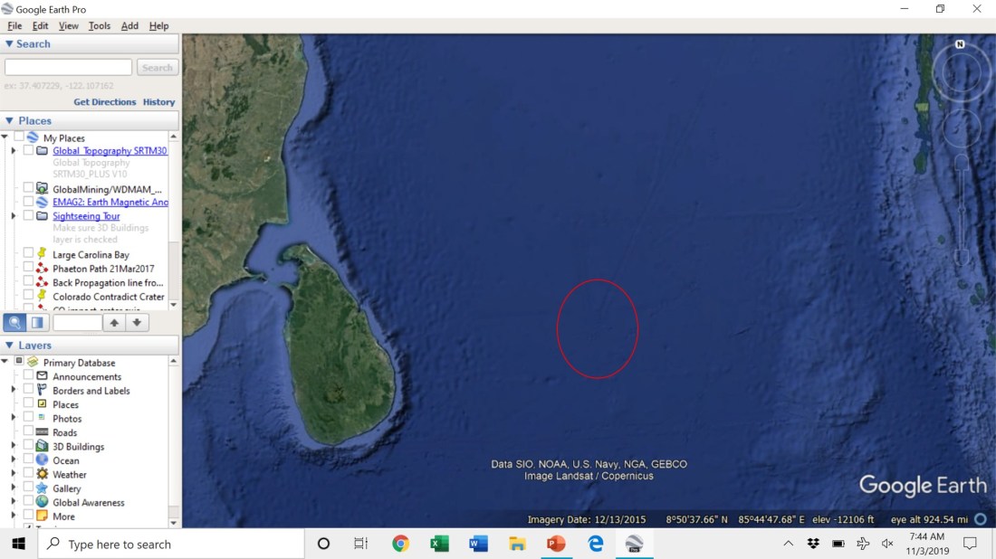
– The second slide is a closer view of the northern part of the Bay. Circled in white is a feature that is magnified on the next slide.
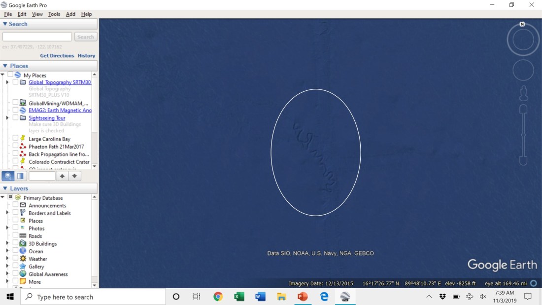
– Slide three’s feature is a river’s oxbows, found at a depth of 8258 ft below present sea level. (BTW: we see these features amidst what appears to be a straight channel – it identifies the track taken by the ship that produced the sounding data.)
– Circled in white and yellow on slide four are the feature from slide three (white) and a similar one (yellow). The yellow region is magnified on slide five.

– The features on slide five are a river’s oxbows at a depth of 9421 feet below sea level.

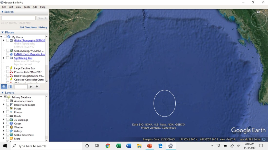
– Slide six shows a wider view of the southern portion of the Bay off Sri Lanka. Circled in red on this slide is another feature that is magnified on slide seven.
– On slide seven, at a depth of 12,232 ft below sea level, are more oxbows. Based on the depth (12,232 ft, close to the 3700 m depth mentioned in the Feakins et. al. PNAS paper), I strongly suspect that this the location from which the IODP obtained the cores used for the study.

– Note that the depth of the oxbows increases in each image. Thus, the Ganges system flowed southward toward a pre-flood basin, an approximation for which is circled on the map on slide eight, below. (This map of pre-flood earth is available in my paper, “The Flooding of the Mediterranean Basin at the Younger-Dryas Boundary,” that addresses the worldwide flood and geology’s historic “no flood, ever” error.)

– The entirety of this formerly subaerial river system explains why we find millions-year old tree remnants submerged in various sediment layers thousands of miles off the present shoreline. They were carried down by the Ganges, buried, then preserved by the river’s floods over the millions and millions of years before the region became submerged by the worldwide flood.
Regards,
Michael
